Components of a Digital
Landscape (data + software)
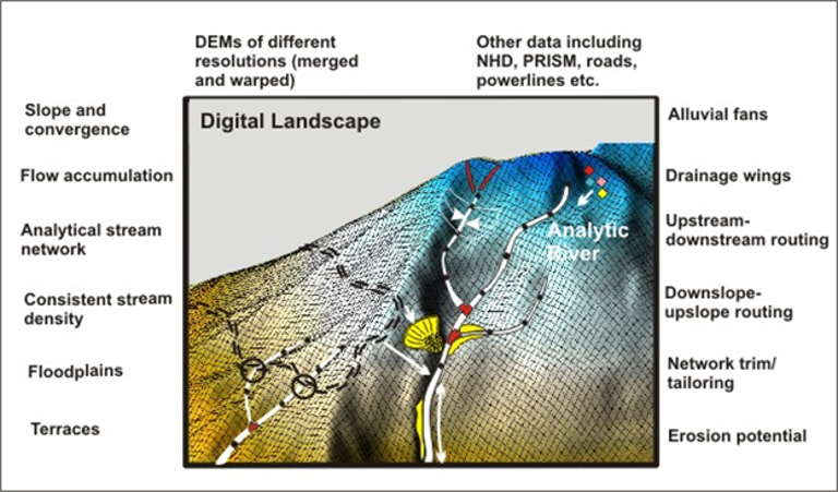
Digital Elevation Model DEM
•Spatial
reference, topography
•Flow
routing; all locations are dynamically linked via flow paths
Linked
channel-node database
•Routed,
attributed channel network; linked to, and at the same spatial grain as, the
DEM
DEM
Explicit Linkages
•Other
data: Land cover, roads, soils, geology, climate, field surveys, ...
•Models:
mass wasting, surface erosion, habitat intrinsic potential, wood recruitment, hydrology, ....