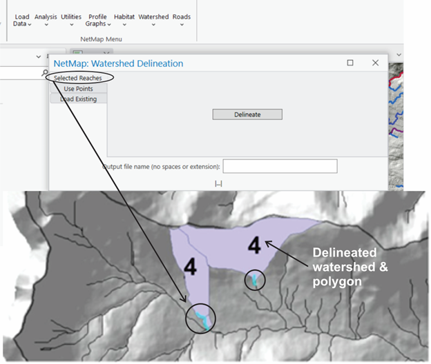
This tool will generate a watershed area polygon from selected stream reaches or points, or a mouse click. The output polygons will have the reach ID as an attribute as well as the watershed area. Delineated watersheds could be used with other NetMap tools such as Sort & Rank and Cumulative Distributions. Watershed polygons includes drainage area in square kilometers.