TODO: To change the footer's content go to Dr.Explain menu Options : Project Settings : HTML (CHM) Export : Setup HTML Template and Layout
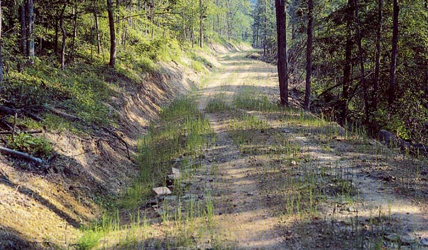
Unpaved Road Sediment Delivery
Field name = [READI]
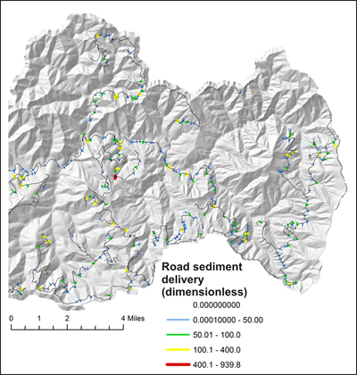
Sediment production and delivery to streams is predicted for unpaved roads using the READI model in NetMap. This attribute refers to the attribute value reported to stream reaches from individual road segments that drain to it. It is dimensionless, providing a relative ranking of high to low sediment delivery potential.
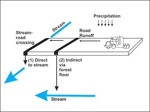
The model applies a design storm, typically a one year - one hour storm and it generates hydrographs at drains and all road - stream crossings. Sediment production and delivery are typically dimensionless, but they provide a relative index of variation in road erosion and delivery potential. Runoff with sediment is delivered directly to streams at road - stream crossings or runoff travels through the forest floor where soil infiltration can reduce the path of runoff and sediment plumes.
This stream attribute shows predicted road sediment production (dimensionless units) in each affected stream segment. Use of dimensionless units is appropriate to create a relative ranking of high to low sediment delivery potential from unpaved forest roads.
Other VIPER road attributes show predicted sediment production and delivery on the road network itself (rather than in streams as shown here) and also the optimal locations for additional road drains and road surfacing to reduce erosion and sediment delivery to streams.
(Left panel) Road runoff and associated sediment enter streams directly at stream - road crossings and indirectly via the forest floor. (Right panel) All unpaved forest roads produce sediment but only a small subset deliver sediment to streams. NetMap Portal provides that prediction on road segments (see another road sediment delivery attribute) and also in streams (above, right). This allows an analyst to search for spatial overlaps between stream segments with high predicted sediment delivery with streams segments of high fish habitat potential, supporting prioritization of erosion reduction mitigation efforts.