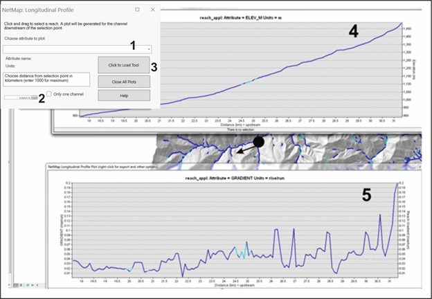
The tool, used in the office or in the field, allows users to quickly display longitudinal profiles of any stream segment attribute in NetMap. A user first selects an attribute and then clicks to load the tool, and selects one reach. The profile is calculated upstream from that reach, for a distance indicated by the user or until the end of the analytic river network ends. Once an attribute is plotted, a user has the option (a dialogue box will pop up) to display other attributes along the profile.
Figure 1. (1) A user selects an attribute to plot. (2) A distance upstream is indicated (in kilometers). If the distance is greater than the actual length of the channel, the plot will encompass the entire channel to the headwaters.(3) The tool is loaded, and a single segment is selected. Shown is a longitudinal plot of elevation (4) and another plot of gradient (5). Multiple attributes can be plotted for a single selected channel. The color legend in the channel reaches will be displayed on the longitudinal plots (5).