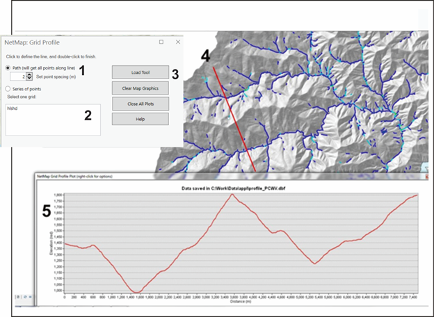
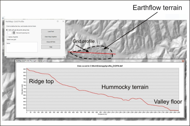
The tool, used in the office or in the field, allows users to quickly display cross sectional profiles of topogrpahy. Across valley topographic profiles reveals hillslope forms, including steepness and benches (Figure 1). The tool can also be used to identify earthflows and deep seated landslides (Figure 2).
Figure 1. (1) A user selects the point spacing along the profile (the minimum = the spatial grain of the DEM, 2 m, 10 m etc.). Selecting a larger point spacing allows the tool to run faster, particularly when plotting over long distances. (2) A grid or raster is selected (based on what is contained in ArcMap's table of contents). (3) The tool is run. The output is found in Arc's table of contents under "long_profiles".
Figure 2. The grid profiling tool is used to identify hillslope instability features, such as deep-seated landslides and earthflows, as illustrated above.