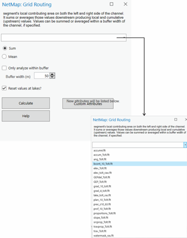
Routing of Hillslope Attributes (including from within a buffer)
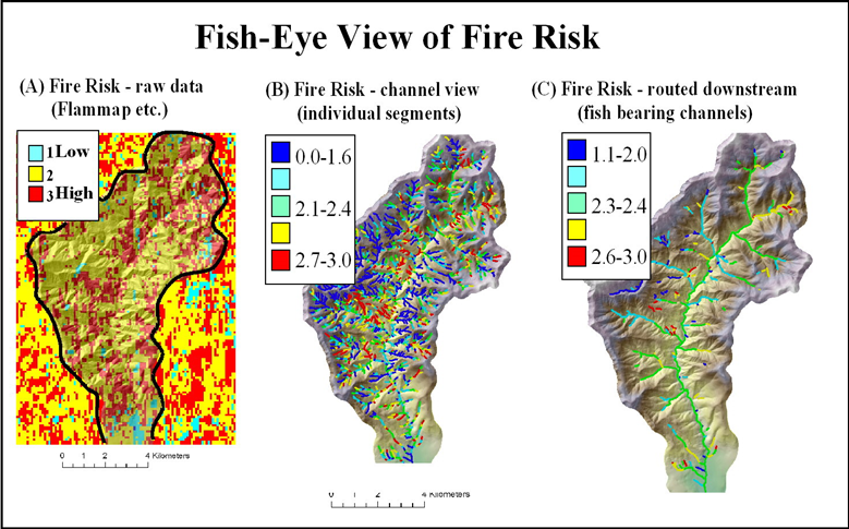
Tool Description:Any hillslope raster (e.g., fire risk, vegetation age, erosion potential etc.), is summarized at the scale of drainage wings, or a portion thereof encompassed within a stream-adjacent buffer or any channel reach attribute can be aggregated downstream. See below for the use of a buffer.
Tool Interface: Select a raster file. Then choose either "sum" for summing values downstream, or "mean" for calculating the average value, aggregated downstream and channel length weighted.
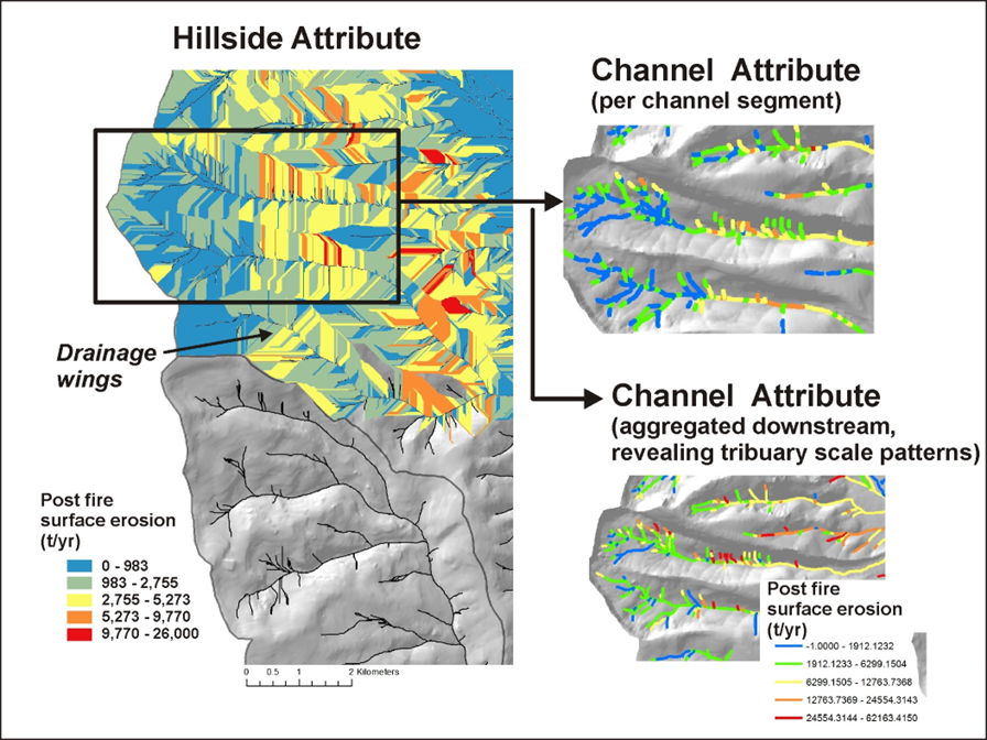
Example: Predicted post fire hillside erosion.
Data are summarized at the scale of drainage wings and then routed downstream.