Road Density (subbasin) or Road Density at the Scale of Stream Reaches
Parameter Description: Road density (km/km2, mi/mi2) is calculated at the scale of individual subbasins, commonly HUC 6th field in NetMap. Users can import their own subbasins or use the ones (HUC 6) bundled with the watershed databases. Users can import their own road layer, although most NetMap watershed datasets will come bundled with a road layer.
Units: Road Density: L/L2 (km/km2); Road Crossing Density: number//L2 (#/km2)
Model Description:
Road density (km/km2) is often used as a surrogate for road related impacts in a watershed (disruption of drainage, increased erosion, fish migration barriers etc.). Typically, road density is calculated at the scale of entire watersheds or subbasins. Road density can be calculated for all features (e.g., all roads) or only for certain types of roads (i.e., logging roads or gravel roads and not paved roads).
In NetMap, road density also can be calculated at the scale of individual stream segments, or at any scale defined by the stream network, using Drainage Wings (see 3.4.3).
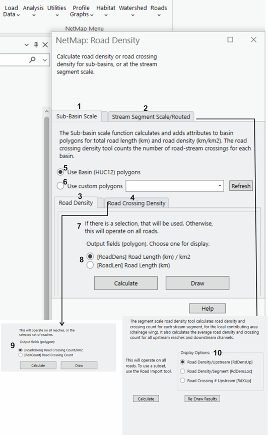
Figure 1. (1) NetMap’s Road Density tool allows a user to calculate road density (3) or stream crossing density (4) at scale of subbasin polygons (1) or stream segments (2) and routed or aggregated downstream (using drainage wings, see 3.4.3). A set of subbasin polygons, typically HUC 12 in NetMap's U.S. virtual watersheds, is available and selected (5). Another (custom) set of polygons can also be chosen (6). The analysis will either work on a selected set of roads or it will operate on all roads (7). Output can include road density (km/km2) or total road length (km) (8). Road-stream crossing density can also be calculated (9).
Road density can also be calculated within individual drainage wings (on both sides of the channel) and reported to individual channel reach segments (100 m length) (2). Display options (10) include road density per channel segments, road density aggregated upstream of segments or road crossing number above channel segment.
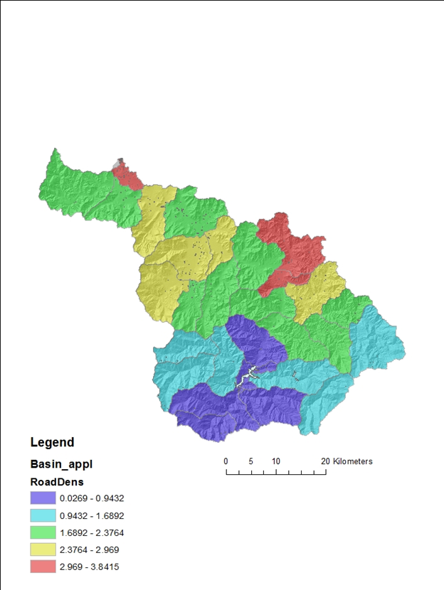
Figure 2. Road density in NetMap calculated at the scale of Hydrologic Unit Code 6th field (12 digit) subbasins. Note how these values are very different compared to road density calculated at the scale of individual channel segments (Figure 3).
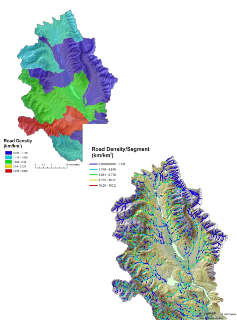
Figure 3. Calculating road density at the stream segment scale provides a much higher resolution mapping of variations in road density. For example, road density in the Clearwater Basin that is calculated at the scale of HUC 6th field subbasins ranged between 0.5 km/km2 and 4 km/km2 (top). In contrast road density measured at the stream segment scale ranged between zero and 100 km/km2.
Other parameters that are created when running the road density tool include:
-road crossing density
-road crossing count
-road length per basin
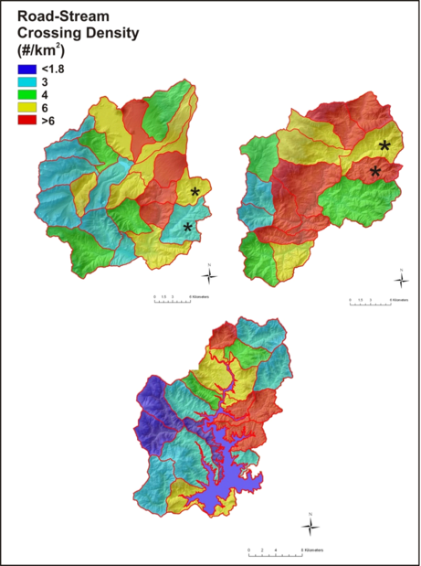
Figure 4. One of the additional outputs when running NetMap’s road density tool is the road-stream crossing per subbasin.