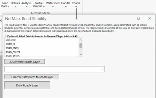
Parameter Description: Road lines are broken at pixel cell boundaries creating pixel scale road mini segments. Then the road mini segments are classified according to any of the available hillslope indices of slope instability potential, such as for example Generic Erosion Potential (GEP) and Shallow Landslide Potential. This index can be used alone or with the prediction of Debris Flow Potential.
A user selects a hillslope attribute to correlate with road crossings, such as Shallow Landslide Potential and Generic Erosion Potential (GEP) (Figure 1). Roads are cut at pixel cell boundaries; see 3.4.3. All road cells are ranked according to the hillslope ratings for erosion potential (that portion of the hillslope that underlies the road segment) (Figure 2). NetMap does not know about the stability of the road prism itself; this must be obtained from field analysis.
Figure 1. The user selects from a series of parameters (2) to classify road networks (at the scale of individual pixels) including shallow landslides, generic erosion potential (GEP), GEP-delivery, shallow landslide potential, shallow landslide potential-delivery (or slope gradient). Selected attributes in the original road layer (1) can be carried over into the new, pixel cell scale road layer. Pixel scale results can be summarized back to the original road segments (3), in terms of average values and values per unit length of road segment.
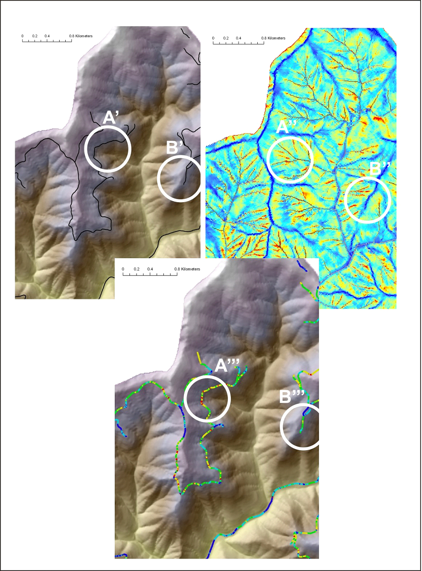
Figure 2. NetMap’s Road stability tool is used to identify where roads intersect hillslope areas of potential stability concern, using parameters such as shallow landslide potential, generic erosion potential, and deep-seated landslide terrain. The road network, discretized at the scale of pixel cells, is overlaid onto the erosion potential map and individual road pixels are classified accordingly. Roads crossing high hazard areas (A’, A’’, A’’’) and crossing low hazard areas (B’, B’’, B’’’) are identified.