TODO: To change the footer's content go to Dr.Explain menu Options : Project Settings : HTML (CHM) Export : Setup HTML Template and Layout
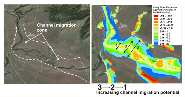
Channel Migration Zone
Floodplain mapping in NetMap Portal can also be used to identify channel migration zones. See examples below.
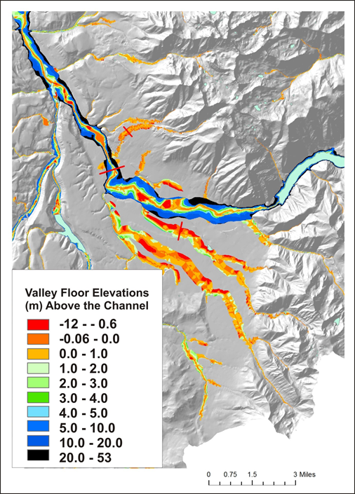
Figure 1. The tool can be used, even with 10 m DEMs, to identify channels on alluvial fans and channels that are incised and thus laterally stable.
Figure 2. The tool can be used, even with 10 m DEMs, to identify channels on alluvial fans and channels that are incised and thus laterally stable.
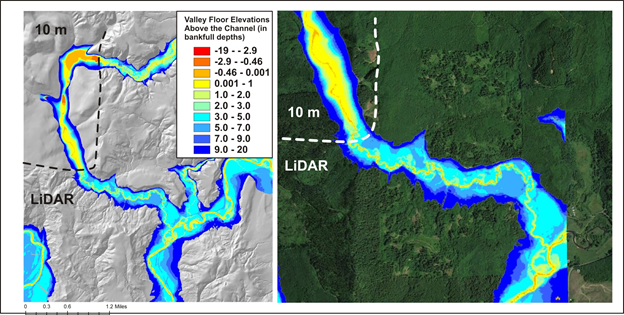
Figure 3. Although there are marked differences between valley floor mapping using LiDAR (2.5 m) versus 10 m DEMs, NetMap's mapping tool can still differentiate attributes of the valley floors, including floodplains, channel migration areas and areas of potential avulsions.