TODO: To change the footer's content go to Dr.Explain menu Options : Project Settings : HTML (CHM) Export : Setup HTML Template and Layout
Floodplain by Bankfull
Floodplains and other valley floor features such as wetlands, oxbow lakes, side channels and alluvial fans can be visually detected using detailed mapping of valley floor elevations in terms of multiples of bankfull depths. NetMap Portal's 'Detailed Floodplain #2' can be applied using high resolution LiDAR or lower resolution DEMs, like the National Elevation Dataset (10 m).
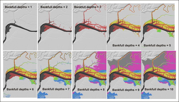
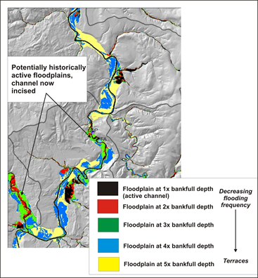
One advantage of mapping floodplains in terms of bankfull depth is that it scales the potential floodplain width to the size of the stream; smaller, four-meter wide channels with a half meter bankfull depth will have smaller areas of inundation compared to 30 m wide channels with 2 m bankfull depth. In addition, geomorphologists often map floodplains in terms of number of bankfull depths; 2-bankfull depth elevations are often considered the floodplain. However, it is likely that areas of 3 and even 4 multiples of bankfull depth are floodplains, but flooded less frequently.
Note that NetMap - Portal's floodplains extend across all streams and hence are much more extensive than FEMA floodplain mapping that is focused around urban areas.
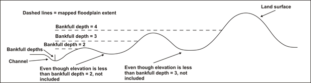
Figure 1. Specifying the number of bankfull depths controls the lateral extent of the floodplain that is delineated. Note that interventing high points, if laterally extensive, will limit identification of floodplains as shown in the figure. Hence, a larger number of bankfull depths will capture a larger extent of the floodplain.
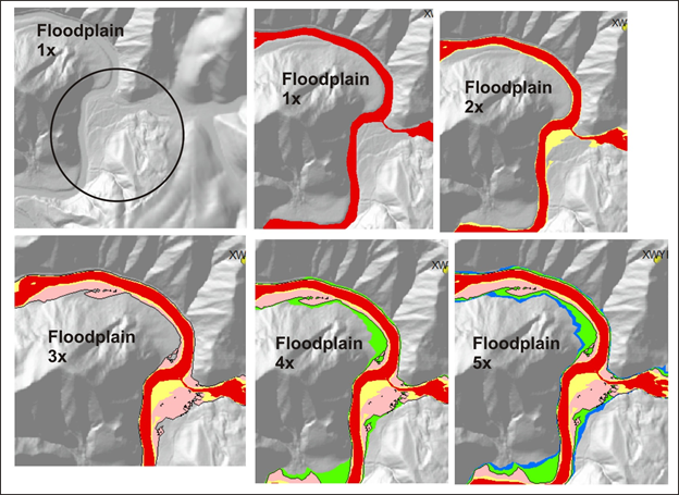
Figure 2. Use of an increasing number of bankfull depths leads to an increase mapped extent of the floodplain. Example is from the Matanuska-Susitina watershed in Alaska.