TODO: To change the footer's content go to Dr.Explain menu Options : Project Settings : HTML (CHM) Export : Setup HTML Template and Layout
Floodplain by Elevation
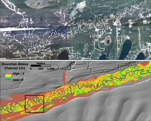
Floodplains and other valley floor features such as wetlands, oxbow lakes, side channels and alluvial fans can be visually detected using detailed mapping of valley floor elevations in terms of absolute elevations. NetMap Portal's 'Detailed Floodplain #1' is in terms of absolute elevations. This is most effective when using LiDAR (1-5m) digital elevation models.
Note that NetMap - Portal's floodplains extend across all streams and hence are much more extensive than FEMA floodplain mapping that is focused around urban areas.
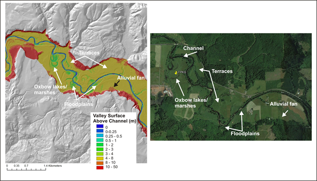
NetMap's valley floor mapping tool, particularly in concert with LiDAR DEMs, can be used to identify oxbow lakes, cutoff meanders, side channels, floodplains, marshes and alluvial fans. Example is from the Nehalem watershed located in northwestern Oregon.
Mapping valley floor elevations and areas prone to avulsions and migration (e.g., channel migration zones) in the Matanuska-Susitna watershed in southcentral Alaska using NetMap tools.