TODO: To change the footer's content go to Dr.Explain menu Options : Project Settings : HTML (CHM) Export : Setup HTML Template and Layout
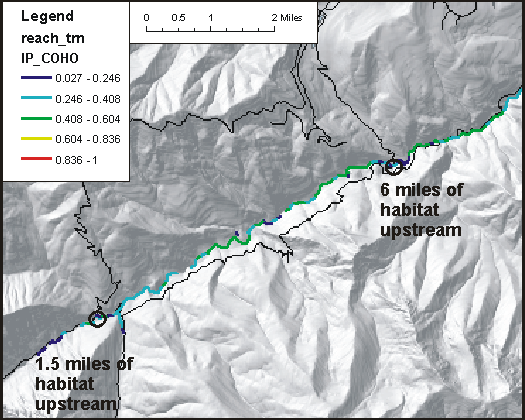
Fish Habitat Length Above Road Crossings
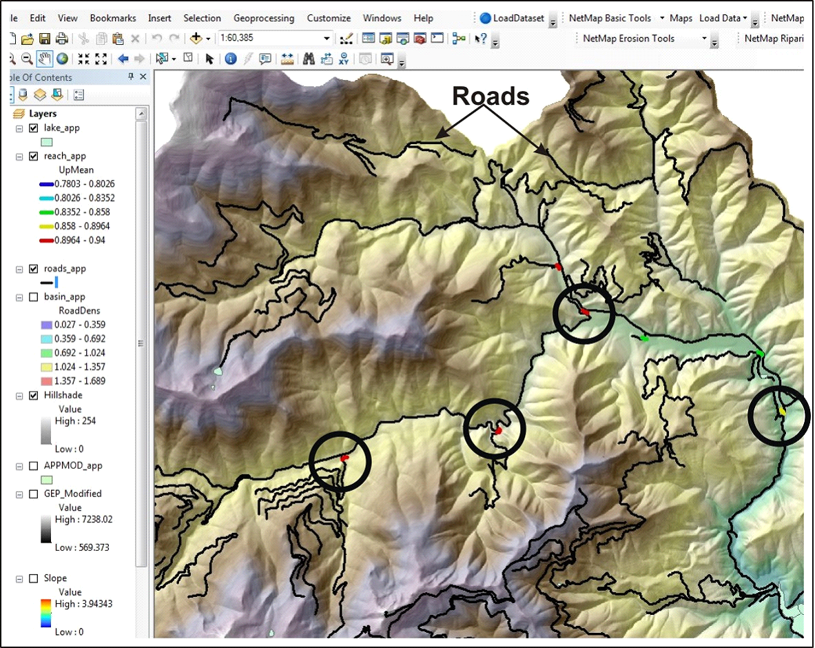
In the Portal, overlay the road layer onto the channel network distribution of the fish species you are interested in. The example below if for coho salmon. In the Portal it is a manual-visual task. However, in NetMap tools (ArcMap add-in), the calculation is automated. See NetMap's full online Technical Help.
To estimate the fish habitat length above road crossing(s) in the Portal, go to the 'Watershed Analyst' page, and select data category "Aquatic" and then display on the map the species of interest, either anadromous or resident. Then scroll to the bottom of the navigation pane and turn on (click) the roads.
(Left panel) Visually estimate the length of fish habitat above specific road crossings. (Right panel). Use NetMap tools to automate the calculation. See Technical Help.