TODO: To change the footer's content go to Dr.Explain menu Options : Project Settings : HTML (CHM) Export : Setup HTML Template and Layout
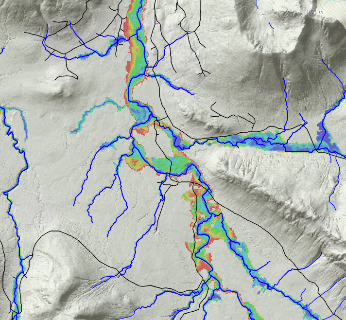
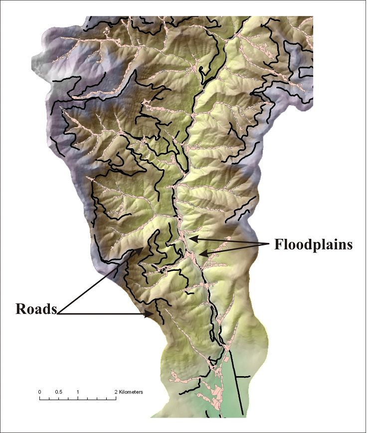
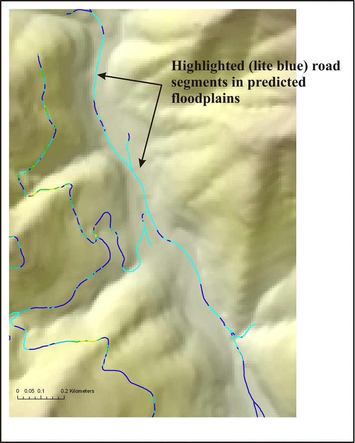
Roads in Floodplains
In the Portal, overlay the road layer onto the floodplain elevation data or floodplain height polygons to visually detect locations where roads are at risk in floodplains or threaten floodplain function. To detect road - floodplain interactions in the Portal, go to the 'Valley/Hillside' page, and select a floodplain data layer. Then in the Navigation panel, turn the roads on. However, in NetMap tools (ArcMap add-in), the calculation is automated. See NetMap's full online Technical Help.
(Left Panel) Use the Portal to identify road - floodplain interactions. (Right panels) In NetMap tools the detection of roads in floodplains is automated. SeeTechnical Help.