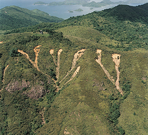
The shallow landslide attribute uses a combination of slope steepness and hillslope curvature to predict susceptibility to shallow landslides based on the model of
Miller and Burnett 2007). The index can be used in humid environments such as the western areas of Washingotn, Oregon, California, coastal British Columbia and southeast Alaska. The index can also be used in semi-arid environments in the western US and beyond to indicate susceptibility to gullying and concentrated sheet wash erosion.
See Warning about using Slope Stability Models.
Shallow landslide susceptibility is also displayed as a channel attribute elsewhere in NetMap Portal.
The shallow landslide attribute uses a combination of slope steepness and hillslope curvature to predict susceptibility to shallow landslides based on the model of
Miller and Burnett 2007). The index can be used in humid environments such as the western areas of Washingotn, Oregon, California, coastal British Columbia and southeast Alaska. The index can also be used in semi-arid environments in the western US and beyond to indicate susceptibility to gullying and concentrated sheet wash erosion.
See Warning about using Slope Stability Models.
The shallow landslide susceptibility index here is a channel reach attribute; to see how hillsope attributes are transferred to channels, see here. The shallow landslide reach attribute can be used to evaluate whether it overlaps with important in-channel characteristics such as fish habitats (using the Environmental Overlap function in NetMap Portal).
Shallow landslide susceptibility is also displayed as a hillslope attribute elsewhere in NetMap Portal.
Additional information:
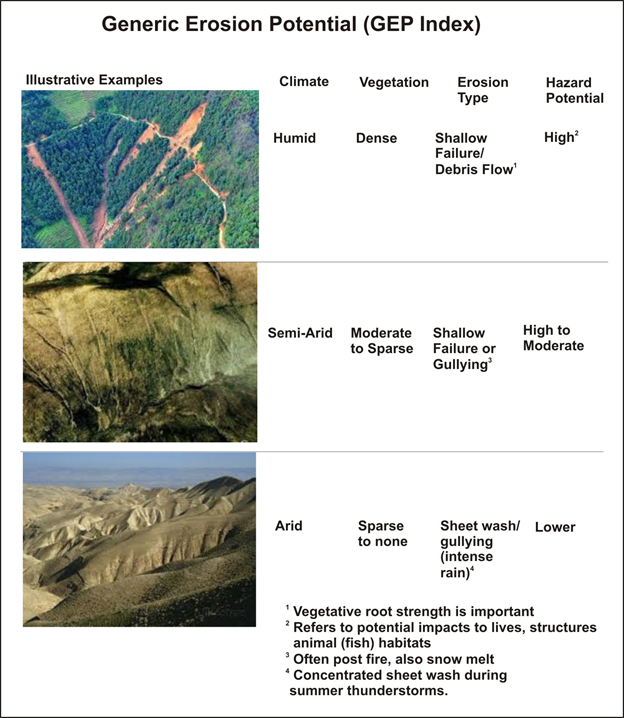
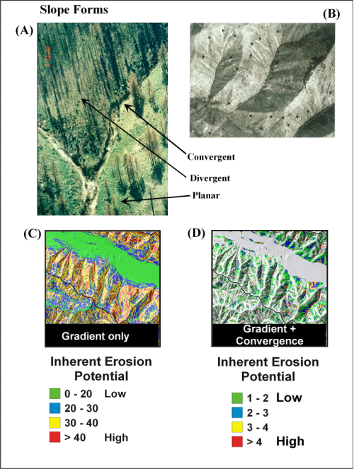
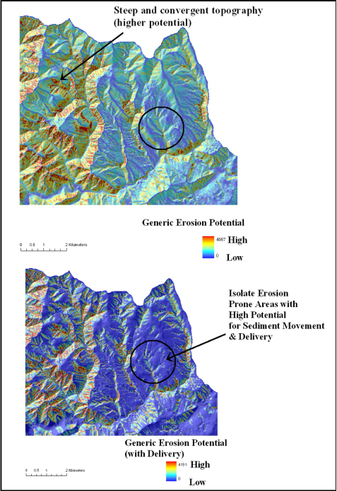
NetMap’s generic erosion potential (GEP) provides a relative measure of potential erosion and it focuses on slope steepness and convergence, recognized topographic indicators of shallow landsliding, gully erosion, and sheetwash (Montgomery and Dietrich 1995, Miller and Burnett 2007, Parker et al. 2010). It is based on topographic attributes of slope gradient, local contributing area, and topographic convergence derived from the DEM:
GEP = S*aL/b
where S is slope gradient (m/m), aL is a measure of local contributing area to a DEM pixel equal to the number of adjacent pixels that drain into it (varies between 0 and 8), and b is a measure of topographic convergence equal to the projection of flow direction out of a pixel onto the pixel edges. Values of b are 1 on planar slopes, less than 1 on convergent topography, and greater than 1 on divergent topography. Larger values of GEP correspond to steeper, more convergent topography. Higher values of GEP correspond to higher landslide densities and, in areas prone to surface erosion, to higher gully-initiation-point densities (Miller and Burnett 2007). NetMap’s GEP index provides a relative measure of erosion potential (e.g., high – low) that encompasses processes of shallow landsliding, gullying, and surface erosion and which can be used in both humid and semi arid landscapes. GEP is referred to as “Erosion” in the Field legend editor. Refer to Figures 1 and 2 on tool use.