TODO: To change the footer's content go to Dr.Explain menu Options : Project Settings : HTML (CHM) Export : Setup HTML Template and Layout
Landslide Risk
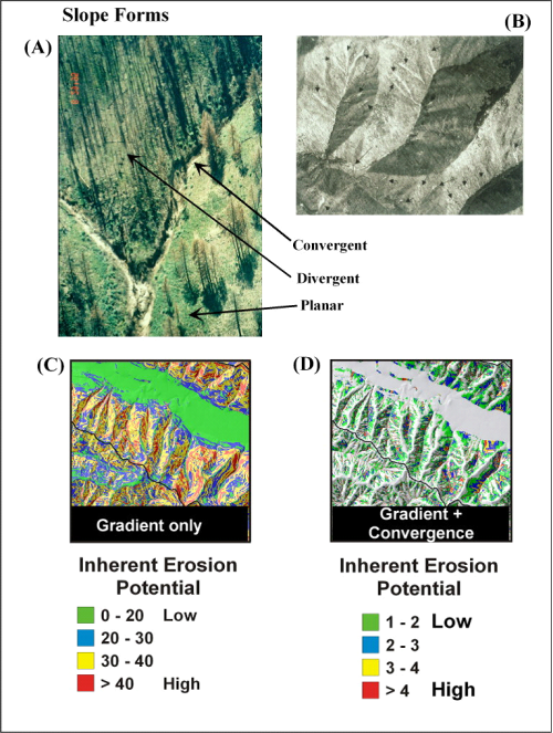
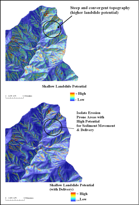
The shallow landslide attribute uses a combination of slope steepness and hillslope curvature to predict susceptibility to shallow landslides based on the model of Miller and Burnett 2007). The landslide potential index (GEP) was calibrated using a large inventory of landslides from the 1996 storm in the Oregon Coast Range. Hence, the shallow landslide attribute here, in terms of risk as number of landslides per square kilometer, is most applicable to the northern and central portion of the Oregon Coast Range.
Professional judgement is advised when applying this attribute to other landscapes. In other landscapes, it is recommended to use the "Landslide Potential" (GEP) index in the NetMap Portal. See Warning about using Slope Stability Models.
The shallow landslide susceptibility index here is a channel reach attribute; to see how hillsope attributes are transferred to channels, see here. The shallow landslide reach attribute can be used to evaluate whether it overlaps with important in-channel characteristics such as fish habitats (using the Environmental Overlap function in NetMap Portal).
If these attributes are not available for your own watershed, please contact us. See more.