TODO: To change the footer's content go to Dr.Explain menu Options : Project Settings : HTML (CHM) Export : Setup HTML Template and Layout
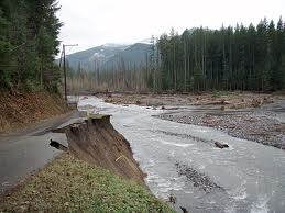
Roads in Floodplains
To identify roads in floodplains simply display the floodplains in the Portal's map viewer and overlap the roads on top of it. See examples below. In NetMap tools (access here) one can use a tool (in the Road module) to automatically detect the intersections between roads and floodplains.
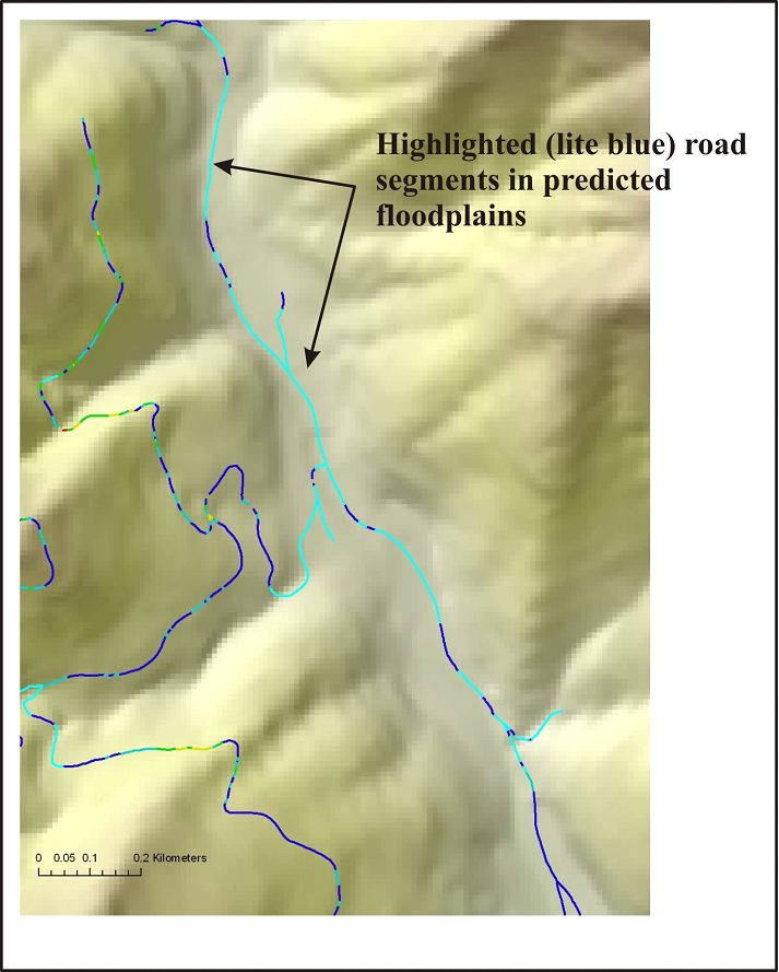
Figure 1. Locations of roads and floodplains are displayed in a basin located in northern California.
Figure 2. The road segments that may be located within floodplains are highlighted (in light blue). The identified road segments (which should be field verified) could potentially be sources of sediment to streams as well as impinging on channels and limiting migration. Road restoration programs could target such areas.