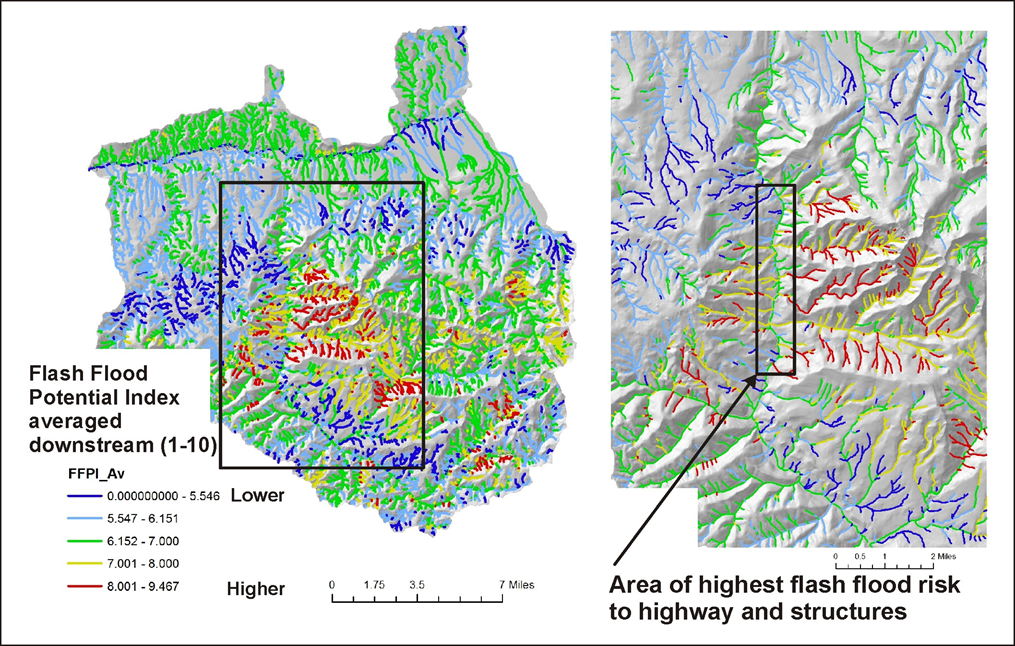
Field name = [FFPI]
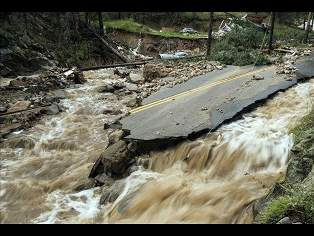
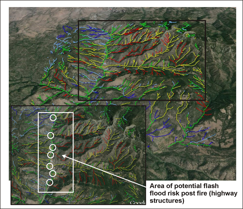
Flash floods are common following wildfires when soil infiltration rates have been reduced, and rainfall runs off ground surfaces. NetMap Portal predicts the potential for flash floods in tributary basins based on four landscape attributes: (1) topography - hillslope gradient, (2) soils, (3) vegetation density and (4) wildfire impacts on soils and vegetation. The flash flood potential index (FFPI) is based on a U.S. National Weather Service Model (Smith 2003, 2010).
Smith, Greg, (2003): Flash Flood Potential: Determining the Hydrologic Response of FFMP Basins to Heavy Rain by Analyzing Their Physiographic Characteristics. A white paper available from the NWS Colorado Basin River Forecast Center web site at http://www.cbrfc. noaa.gov/papers/ffp_wpap.pdf, 11 pp.
Smith, Greg. E. (2010). Development of a flash flood potential index using physiographic data sets within a geographic information system. MS thesis, University of Utah.
Model Description:
The Flash Flood Potential Index (FFPI) takes into consideration the potential for flash floods to develop, given sufficiently intense rainfall (could be combined with snowmelt), based on hillslope gradient (effects of overland flow velocity and hence time of conentration), soils (the proportion of silt and clay that contributes to surface runoff potential) and vegetation density (forest, shrub and herb), with lower vegetation densities promoting higher flash flood potential (note that the LandFire data used for vegetation densities also includes development, a proxy for impervious area). Wildfire severity can impact soils and vegetation density in the FFPI model.
The FFPI model provide a dimensionless index from 1 to 10 (1 = lowest potential and 10 = highest potential).
FFPI = [M (WM) + S (WS) + V (WV)] / N, where
M = hillslope gradient (L/L), S = soil, percent sand (inversley proportional to percent silt and clay), V = vegetation (forest, shrub and herb) density ranging from 0 to 100% (and can include developed areas); MM, WS and VV are weighting factors that can be optionally applied; N is the sum of M (WM) + S (WS) + V (WV) where M, V and S are each equal to one. Thus, N = 3 if there are no weigting factors.
For additional information, go here.