Post Fire Surface Erosion
Field name = [WEPPyld99]
The susceptibility of hillsides to surface erosion and the potential of sediment delivery to enter stream channels are governed by hillslope topography (gradient, profile, proximity to a channel), vegetation (or lack thereof, via wildfire), soils and climate.
Susceptibility to surface erosion in non fire and post wildfire situations is predicted in NetMap using the WEPP Disturbed model. The spatially explicit version of the WEPP model can be used to evaluate four situations: (1) no fire (surface erosion potential for unburned conditions using mapped vegetation classe), (2) Pre Wildfire (severity only) (surface erosion potential based on the predicted fire severity, (3) Pre Wildfire (burn probability combined with fire severity) and (4) Post Fire ( post-fire erosion (severity) with a user-provided land cover layer that includes actual fire severity values.
Model output is a distribution of predicted annual sediment yields in tons per year. NetMap reports the 99th percentile of that distribution.
Model Description:
The Water Erosion Prediction Project (WEPP) is a physically based erosion model developed by a group of US Federal Agency scientists: the Agricultural Research Service, US Forest Service, Natural Resources Conservation Service, Bureau of Land Management, and the US Geological Survey. WEPP contains modules that account for the processes of surface hydrology, winter hydrology, water balance and percolation, soils, plant growth, plant residues, and hillslope surface erosion. Cligen is used to simulate weather to run the erosion calculations. Hillsides are divided into “drainage wings”, local contributing drainage areas on either side of channel segments (Figure 1). Each drainage wing in NetMap is divided into three Overland Flow Elements (OFE); the OFEs are used to calculate surface erosion using WEPP, thus providing a spatially explicit analysis of the responses of multiple hillslopes to unburned land cover type, to postfire burn severities, and to pre-fire projections of burn probabilities and severities. WEPP is run in continuous simulation mode for 100 or more years.
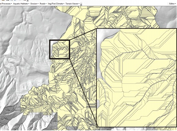
Figure 1. “Drainage Wings” in NetMap are used in the application of WEPP (Disturbed) for standard vegetated conditions, post wildfire and pre wildfire estimates of surface erosion.
Example Applications
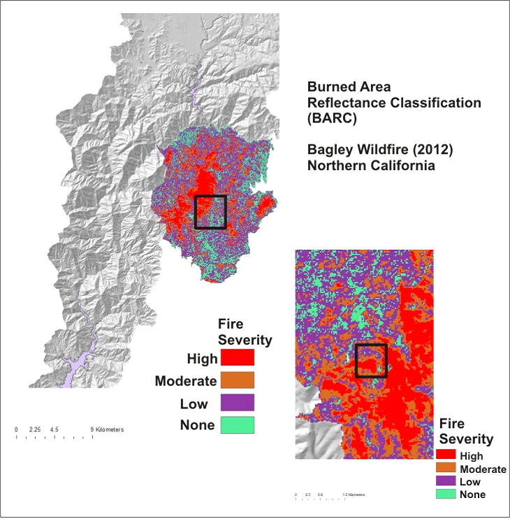
Figure 2. A burn severity map from the 2012 Bagley Fire in Northern California, used in the NetMap-WEPP tool.
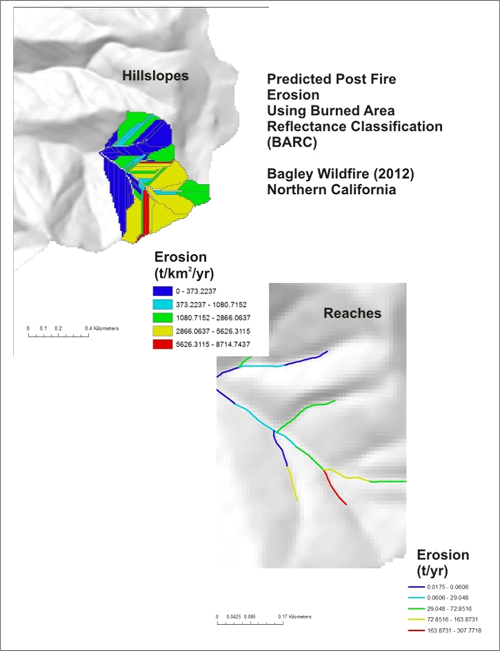
Figure 3. Results from using the burn severity map in the NetMap-WEPP tool.
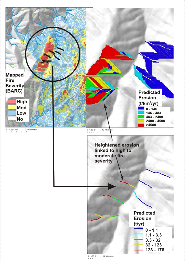
Figure 4. Results using a fire severity map. The upper left panel shows the mapped fire severity (high, moderate and low). The upper right hand panel shows the predicted hillslope erosion. The lower right hand panel shows the predicted erosion in the stream channels. Note that the highest mapped fire severity (upper left hand panel) is associated with the highest predicted erosion potential (WEPP), on the hillslopes and in the channels. Area of low fire severity or no fires are predicted to have the lowest erosion potential.