Note, the fish distribution for anadromous habitats follows the "streamnet" mapping (for confirmed fish bearing streams) and it extends the distribution beyond that to all streams and rivers that are potential habitats based on gradient and flow thresholds in the intrinsic potential model, including those systems where fish are extinct or extirpated. In this approach, all channels that might have been accessible, but are no longer, are included in the TerrainViewer. For source data, see:
http://www.streamnet.org/mapping_apps.cfm
In Alaska, ADF&Gs Anadromous catalogue is used (for confirmed fish bearing) although the mapped distribution in the TerrainViewer extends beyond that to include all potential habitats as defined in the channel gradient and flow thresholds in available intrinsic potential models.
For resident fish, a channel gradient threshold cutoff of 20% is used.
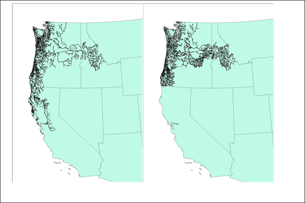
Figure 1. Streamnet distribution in the lower 48 states for coho and Chinook, combined (left panel) and steelhead (right panel).
Note that users with access to NetMap tools can change fish distributions and modify existing fish habitat models or create new habitat models.