NetMap's Watershed Assessment
Data Type: line (road attribute)
Field Name: roadx; Road stability
Selected attributes in the original road layer can be carried over into the new, pixel cell scale road layer. Pixel scale results can be summarized back to the original road segments, in terms of average values and values per unit length of road segment.
NetMap Module/Tool: Roads
Model Description:
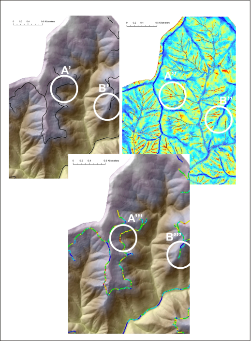
GIS Road line shape files are cut at pixel cell boundaries; see Drainage Wings. All road cells are ranked according to the underlying hillslope ratings for erosion potential (that portion of the hillslope that underlies the road segment) (Figure 1). NetMap does not know about the stability of the road prism itself; this must be obtained from field analysis.
Figure 1. NetMap’s Road stability tool is used to identify where roads intersect hillslope areas of potential stability concern, using parameters such as shallow landslide potential, generic erosion potential, and deep-seated landslide terrain. The road network, discretized at the scale of pixel cells, is overlaid onto the erosion potential map and individual road pixels are classified accordingly. Roads crossing high hazard areas (A’, A’’, A’’’) and crossing low hazard areas (B’, B’’, B’’’) are identified.