NetMap's Watershed Assessment
Watershed Attribute: Road density (km/km2, mi/mi2) is calculated at the scale of individual subbasins, commonly HUC 6th field in NetMap. Requires road layer.
Data Type: polygon
Field Name: RoadDens;
Units: Road Density: L/L2 (km/km2 or mi/mi2); Road Crossing Density: number//L2 (km/km2)
NetMap Module/Tool: Roads (Transportation/Energy)
Model Description:
Road density (mi/mi2, km/km2) is often used as a surrogate for road related impacts in a watershed (disruption of drainage, increased erosion, fish migration barriers etc.). Typically, road density is calculated at the scale of entire watersheds or subbasins. Road density can be calculated for all features (e.g., all roads) or only for certain types of roads (i.e., logging roads or gravel roads and not paved roads).
In the Watershed Assessment road density is also calculated at the scale of individual stream segments, or at any scale defined by the stream network, using “Drainage Wings” (see next).
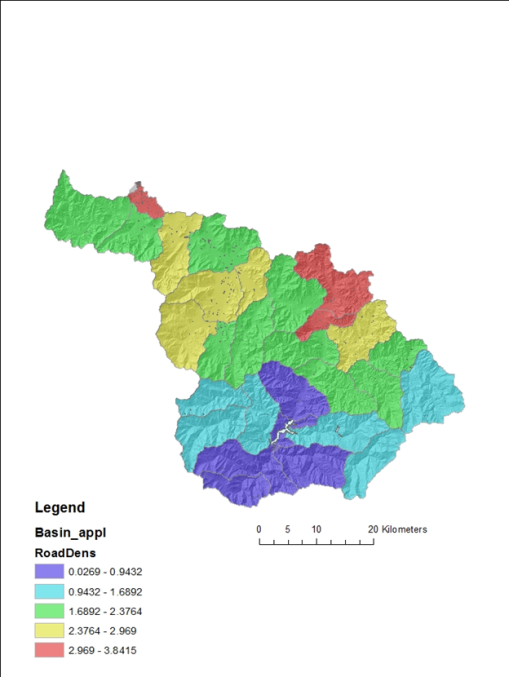
Figure 1. Road density in NetMap calculated at the scale of Hydrologic Unit Code 6th field (12 digit) subbasins. Note how these values are very different compared to road density calculated at the scale of individual channel segments (see next).
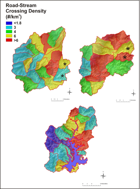
Figure 2. One of the additional outputs when running NetMap’s road density tool is the road-stream crossing per subbasin.