Road Density (channel segment)
NetMap's Watershed Assessment
Watershed Attribute: Road density (km/km2, mi/mi2) is calculated at the scale of individual stream segments (50 - 200 m) and thus at the scale of individual drainage wings (~0.1 km2). For additional informtation on road density and using NetMap's road tools, see also http://www.netmaptools.org/Pages/Clearwater_NetMap_final.pdf.
Data Type: line
Field Name: RdsDensLoc; Road Density (Reaches)
Field Name: RdDensUp; Road Density, Aggregated from upstream to any downstrean reach
Field Name: RdDensDown; Road Density, Aggregated downstream to any upstream reach
Field Name: RdDensL; Road Density, Segment Left side (looking downstream)
Field Name: RdDensR; Road Density, Segment Right side (looking downstream)
Units: meters, L/L2, #/L2
NetMap Module/Tool: Roads
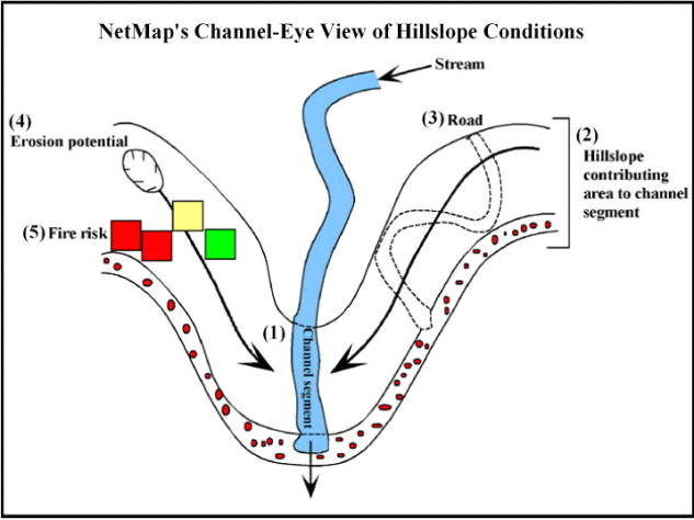
Model Description: In NetMap, the density of roads is calculated at the channel segment scale (20 – 200 m). This is accomplished by measuring the length of roads that pass through the local contributing drainage areas (e.g., drainage wings) of individual channel segments (from both sides of the channel); see Figures 1 and 2. Data include segment-based road density aggregated downstream, thus yielding an estimate of road density at any spatial scale defined by stream networks (Figures 3 and 4).
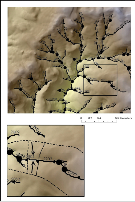
Figure 1. NetMap applies a universal data structure to all of its watershed analyses. This involves organizing river networks into stream segments (with Ids), confluence nodes, and local contributing drainage areas. Hillslope and channel information is routing downstream revealing patterns across multiple scales.
Figure 2. In NetMap, certain hillslope parameters are aggregated into the nearest and downslope stream channel segment (1). NetMap determines the contributing hillslope area that drains into channel segments (on both sides of channels) that range in length from 20 to 200 m (2). The algorithm then determines the amount of road length that intersects those contributing areas and calculates a channel segment-based road density (km km-2) (3). NetMap also aggregates segment-based values downstream throughout a river network (which can be viewed either as the aggregated value from upstream or downstream), yielding drainage area weighted values for road density.
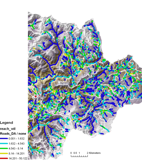
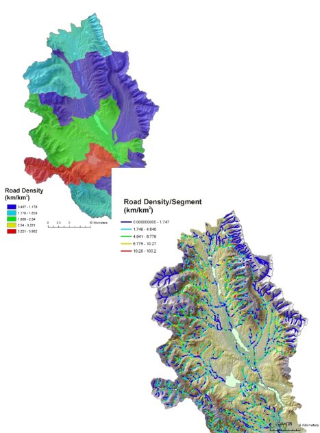
Figure 3. Road density (km/km2) at the channel segment - drainage wing scale.
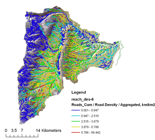
Figure 4. Calculated road density aggregated downstream, revealing tributary and watershed scale patterns.
Figure 5. Calculating road density at the stream segment scale provides a much higher resolution mapping of variations in road density. For example, road density in the Clearwater Basin that is calculated at the scale of HUC 6th field subbasins ranged between 0.5 km/km2 and 4 km/km2 (top). In contrast road density measured at the stream segment scale ranged between zero and 100 km/km2.