NetMap's Watershed Assessment
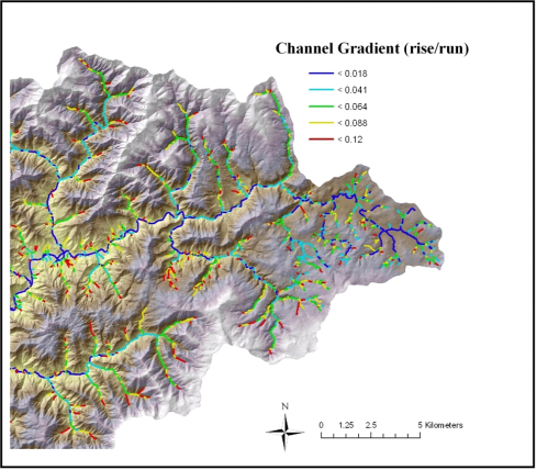
Watershed Attribute: Channel gradient (rise/run, m/m).
Data Types: Line (stream layer)
Field Name: Reach Gradient
Units: m/m
NetMap Level 1 Module/Tool: Fluvial Processes/Network Variables
Model Description: Reach gradient is calculated from digital elevation models (commonly 10-m DEMs) at the scale of channel segments (20 – 200 m). The DEM-inferred gradient using the DEM-delineated flow path uses a nine-point surface polynomial as described by Zevenbergen and Thorne (1987). Variation in channel (Figure 1) is important in habitat indices, channel classification, stream power, channel sedimentation, and channel disturbance zones, among other watershed attributes.
Figure 1. NetMap is used to calculate channel gradient across the channel network.