NetMap's Watershed Assessment
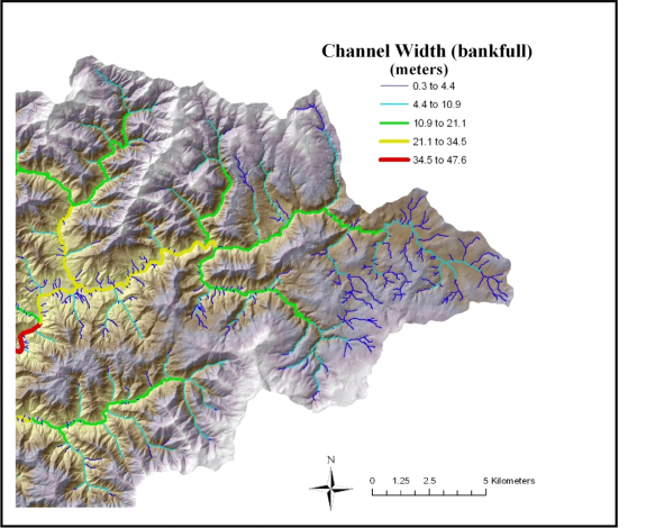
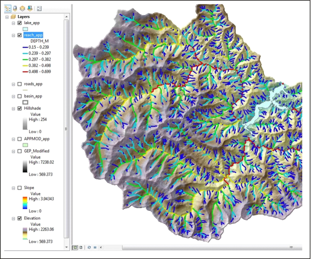
Watershed Attribute: Channel bankfull width, depth and mean annual flow.
Typically predicted using USGS regressions for hydraulic geometry
Data Types: Line (stream layer).
Field Name:
Bankfull width: ACW_M
Bankfull depth: DEPTH_M
Mean annual flow: MEANANNCMS
Units:
Bankfull width - meters
Bankfull depth - meters
Mean annual flow -cubic meters per second
NetMap Level 1 Module/Tool: Fluvial Processes/Hydrualic-Planform Geometry
Model Description: In NetMap, statistical regressions are used to predict bankfull channel width, depth and mean annual flow. They are generally modeled as a power function of mean annual flow, drainage area and or precipitation; see Leopold and Maddock 1953 and Clarke et al. 2008. Channel bankfull depth is used in numerous applications in NetMap, including in the prediction of flooplains. Refer to the meta data for specific regressions used or contact TerrainWorks.